
Ask iris a geospatial question and get a verifiable plan and pipeline in minutes.

iris composes a runnable pattern from methods we've already built. You can visually inspect every step, change anything, and re-run. Glass-box GIS, at your service.

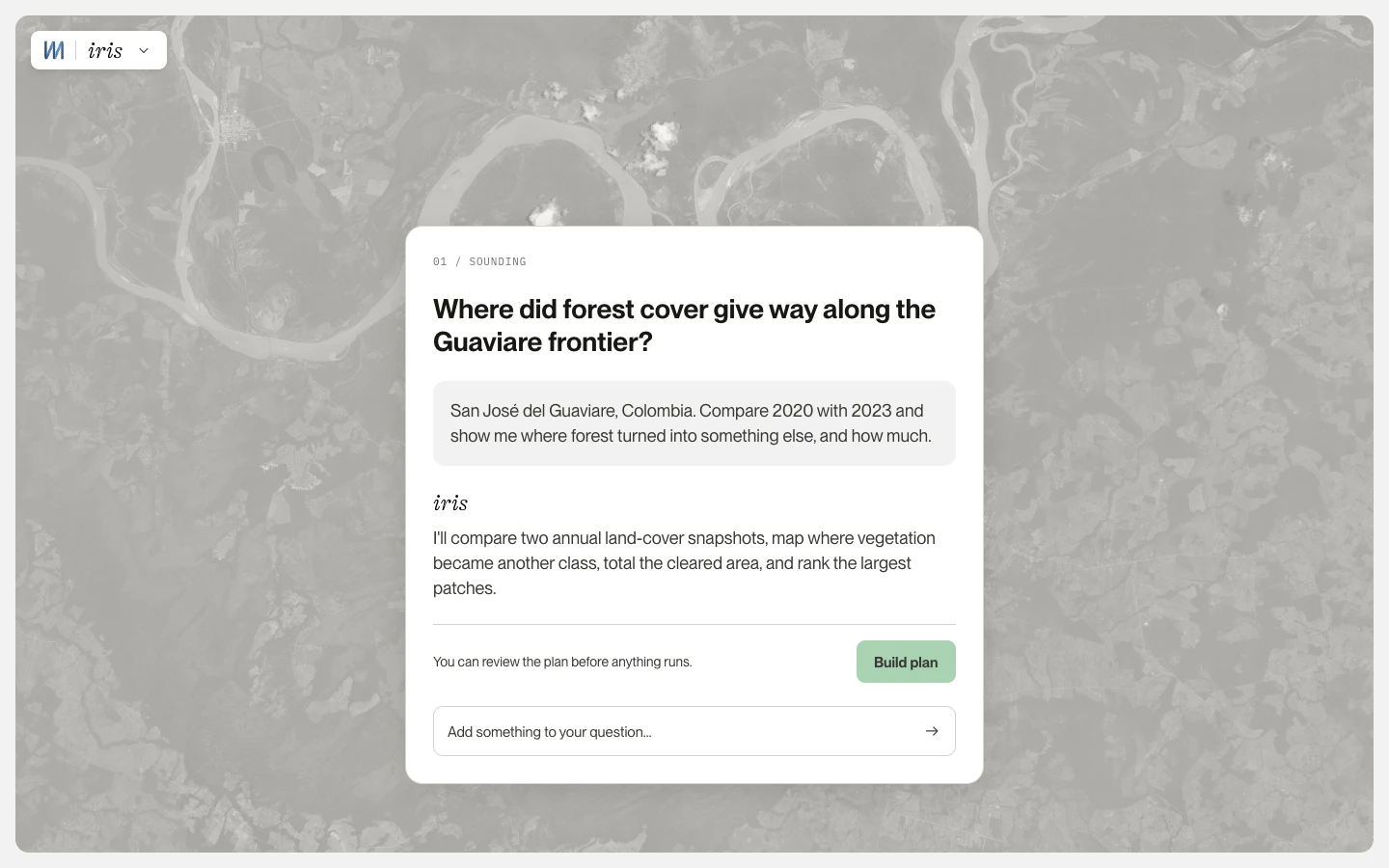
Simply start with a question like, 

iris, as a glass box.

Every composed step is named and openable. Every run leaves a provenance record of what ran, on what data, in what order.

You might be wondering what the deal is. Is this a sales page? Where’s the catch!

There isn’t one. iris is in beta, and we’re giving free invites to early testers like you. Scroll around the page for more on how it works.

You’ll get your own account to run iris on your geospatial questions. No credit card, no contract. The exchange is a good one: You’ll jump on a video with Matt (our head of product!) to walk through it and talk shop.

Your access lasts through beta, plus a few months totally free after. If you leave, you keep your outputs and provenance.

Named steps Provenance record Outputs + ZIP Ordered run history

Old way · prep

Stop rebuilding imagery, CRS, and resolution glue.

Multi-sensor asks (including SAR flood / multi-date composites in the catalog) become a composed pipeline aimed at your outcome. You still own the steps.

Old way · notebooks that die

A pattern you can hand to the next corridor.

Save the analysis as a reusable pattern in iris. Open it, change parameters, run again, without rewriting the script stack.

Old way · starting over

More finished analyses per week.

Throughput for people who already know GIS, not a substitute for judgment.

01 New way · Ask

“What do you want to find out?”

Describe the outcome in plain language, like “where farmland turned into housing near Fresno since 2019.” No jargon required.

02 New way · Composing

Iris writes the method.

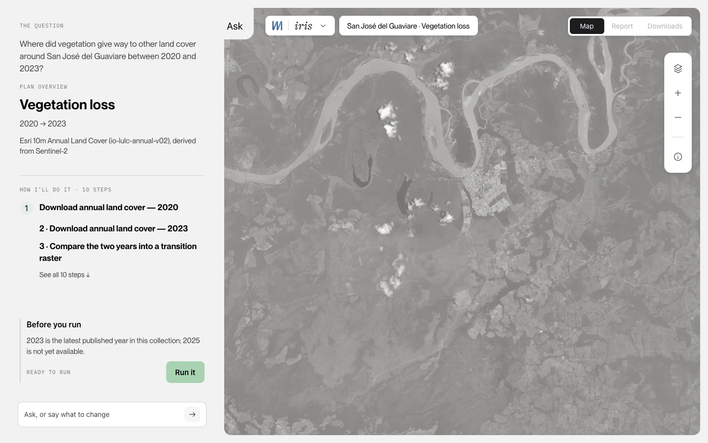
The plan streams in as a checklist while iris composes: imagery, indices, every step named from the catalog.

03 New way · Plan

“Nothing runs until you say so.”

“Here’s what I’ll build”: a numbered plan with a match score (can iris build this from the catalog?). Not a claim that the map is “correct.” Adjust any step, save it, or run it.

04 New way · Inspect

Open the pipeline. Question the result.

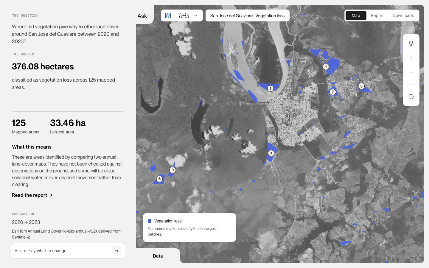
Map layers, downloads, follow-ups. Then save as a reusable pattern. In iris, every step stays inspectable.

From question → catalog method → result you can defend.

Four phases. You stay in control.

Invite-only. Free access to use iris, short interviews, no pricing. We reply within two working days.

How a plan forms in iris

Ask once. Open every step. Run when you say so.

A walkthrough of the loop: plain language in, catalog method out, nothing executed until you press Run.

Ask

Describe the outcome the way you’d brief a notebook: a place, a change, a date window. No sensor jargon required. Iris treats that ask as the brief for a method, not a sealed answer.

You name the outcome. iris assembles it from a catalog of methods we've already built and tested, then shows you the plan before anything runs: change detection, spectral indices, SAR flood mapping, multi-sensor work.

If your ask falls outside what the catalog covers, iris says so and asks. It won't quietly substitute something close and let you discover it three steps later.

Access & your data

iris is an invite-only research beta behind sign-in. We read every invite. Small team, no bots. Free access on your own questions, plus short interviews about how it went. You point iris at an AOI so we can run the analysis with you. Your work never disappears into a sealed box.

  • Hosting. Hosted on major cloud infrastructure; region details shared with invitees.
  • Retention. Run outputs and AOIs are retained for the beta period. Invitees can request deletion at any time.
  • Delete on exit. When you leave the beta, you can request deletion of your runs and AOIs.
  • Training. We do not use your AOIs or run outputs to train third-party foundation models. Product improvement from beta is via interviews and opt-in feedback, not silent training on your scenes.

Provenance, every run

We've got receipts! Every composed step is named and openable. Every run leaves a provenance record of what ran, on what data, in what order. You can open any step of any run, change a parameter, and re-run.

The match score describes the plan, not the pixels. It tells you how much of your request iris could build from methods it already has. Twelve of fourteen steps matched means twelve it had and two it didn't. It is not a claim that the map is correct. When the match is thin, iris says so instead of papering over it.

What you can take with you

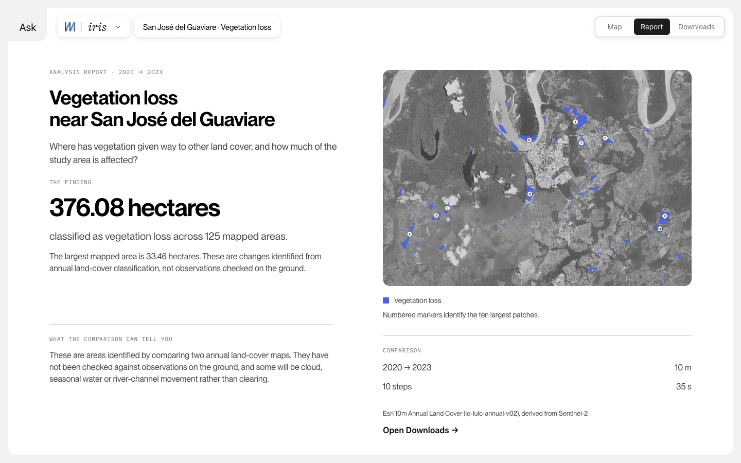
Export today is a ZIP from iris: your outputs plus the provenance record for the run. If you leave the beta, you leave with your work, and you can request deletion of your runs and AOIs when you exit.

Export to your own cloud is not a product feature yet. When that boundary changes, this page changes with it.

Sample · what’s in the ZIP / provenance record

run_id:          sarangani-m63-2026-08-07-demo
aoi:             Sarangani Bay AOI
sensor:          Sentinel-2 L2A
scenes:          S2B_MSIL2A_20260718… · S2A_MSIL2A_20260806…
windows:         pre 2026-07-01→08-04 · post 2026-08-06→08-07
params:          max_cloud=35% · ndvi_thr=-0.15
task_order:      AOI-SET → S2-L2A-FETCH → GRID-ALIGN
                 → IDX-NDVI-CHG → IDX-NDBI-CHG → RANK-PATCH
outputs/:        change_mask.tif · ranked_patches.geojson
provenance.json: task ids · params · scene lineage  · example

The method catalog

The same catalog described above. You name the outcome, iris picks from methods we've already built, and you see the plan before anything runs.

Coming later (not shipped): map-forward composition, curated template gallery, richer data joins.

Upcoming plans

  • Public API
  • Agent connectors
  • Sovereign / on-prem options
  • SOC 2, FedRAMP, and similar certifications
  • Map-forward composition, curated template gallery, richer data joins

…and lots more in the roadmap we can’t leak just yet!

A note from the founder

M33 exists to close the gap between what sensors observe and what a decision-maker can act on, and defend afterward.

The geospatial pipeline has an architecture problem, not a data problem. iris is our answer to one piece of it: a glass box instead of a black one. In our own testing, a job that took an analyst just under four hours came back in about thirty-five minutes, both sides on the clock. But the part that matters isn't the clock. It's that every step is named, openable, and yours to question, change, and re-run.

We're a small team, onboarding in small cohorts. Request an invite and you'll hear back from one of us personally.

You don't have to hand us client work to find out whether this is useful. Try it on a test project, an idea you're chewing on, a question of your own. And if you are weighing client work, read the sections above. We wrote them to be read that way.

Michael Keys, Founder

FAQ

What can iris run today?

Change detection, spectral indices, SAR flood mapping, multi-sensor work, and a good deal more. The catalog grows most months, and beta users are the reason it grows in the direction it does.

What does the confidence score mean?

How completely we can build your request out of methods we already have. It is not a claim about accuracy, and it is not a benchmark score. A high number means iris understood the ask and has the pieces for it, not that the answer is right. That judgment is still yours.

Is this no-code GIS?

No. You describe the outcome; you get an inspectable pipeline. Built for people who already know the analysis.

What do you do with my data?

Sign-in beta; we review every invite. Runs leave outputs plus a provenance record. Export today is a ZIP from iris, not export-to-your-cloud. See Data & trust.

Builder vs templates: what’s protected?

Builder runs in iris stay glass-box: inspect and edit the composed pipeline. Curated templates (as they land) give methodology + lineage for reuse, not a rebuildable dump of internals.

What’s the beta bargain?

Free access to use iris. Short interviews about your workflow. Keep ZIP + provenance when you leave. Reply within two working days. No card, no pricing in this cohort.

Research cohort·free to use · no pricing

Free iris through beta, plus a few free months once it launches.

Read data & retention
01 · Invites

We're a small team, but responding personally to every invite.

We're onboarding in small cohorts for free access.

02 · Open steps

No sealed answers.

Open any step of any run in iris, change a parameter, re-run.

03 · Keep it

Leave with your work.

Outputs plus a provenance record of what ran, exportable as a ZIP.

Team M33
Michael Keys

Michael Keys

Founder / CEO

Building since 18 across marine and charter, sales, design, and marketing. Work that has to hold up for real customers, not just look good on a slide.

He founded M33 from a long interest in space, technology, and systems design: so spatial questions can be asked in plain language, and the answers are ones people can use.

Matt Gawlik

Matt Gawlik

Head of Product & Eng

Software engineer turned product leader who owns the full arc: vision, strategy, release, training. Began his career writing flight software for satellites, including the star-tracking “eyes” of the James Webb Space Telescope, and has built in trust-critical industries: elections, risk, insurance, where data is worthless without provenance. In tech since his teens, across startups and multinationals.

Julian Leach

Julian Leach

Chief of Staff

Works alongside Michael to keep strategy and commercial work pointed at the people iris is for: turning direction into clear priorities and practical progress.

Brings 25 years as a strategy consultant, founder, and CEO, including building two startups over twelve years, to help get the product into users’ hands and keep it useful once it’s there.

Islam Abdelhamid

Islam Abdelhamid

Engineer

12+ years building software where trust, reliability, and data quality are non-negotiable. AI-powered trading systems, financial-intelligence platforms, payments, and enterprise products. Pairs full-stack engineering with cloud infrastructure, DevOps, and site reliability, taking products from concept to production without a large team.

Geospatial team who pressure-test iris
  • Juan David SantanaGIS/SPECIALIST
  • Rafael CasagrandeGIS/SPECIALIST

They pressure-test methods and language with us: what enters the catalog, break things so we can keep fixing them and repeat!

Advisors

Matt Martinez

Space & SAT Market

VP of Transformation at Viasat and ex-BCG, brings consulting-grade strategy and an operator’s playbook for scaling, plus an insider’s read on the space/satellite industry we’re entering.

Behrang Koushavand, PhD

AI Architecture

Geostatistician and professional engineer, 19 years spanning subsurface ML and geospatial analytics. Pairs deep earth-science modeling with the exact natural-language-to-AI stack iris runs on.